

There’s an expression in the gridding community called “gridding out” a mountain when you finish hiking it at least once in every calendar month. You need to do that for each of the forty-eight 4000-footers on the White Mountain 4000-footer list to finish the grid (48 x 12 for 576 summits), which requires about 3000 miles of hiking with 1,000,000 feet of elevation gain to complete, although you can take multiple years to finish. Most people do.
April is considered the hardest month to climb 4000 footers on the White Mountain 4000 footer list because conditions are so variable. The summits are usually snowcapped while the valleys are soaked in mud. Depending on the day, some of the ice bridges that span smaller stream crossings may be intact, while the major rivers may be running at flood stage from snowmelt. It’s not unusual to carry snowshoes, crampons, microspikes, and wiggy’s waders on a hike because they may all be necessary at different points or elevations on the route. You never know.

Come this April, I had climbed Mt Carrigain 11 times in 11 different months, with just April remaining. My goal was to hike it early in the month before the snowpack turned to slush and the climb would be much more strenuous. We’ve had an extraordinary amount of snow this year in the Whites, more than any in the past 5 years, which has begun to make hiking this spring quite challenging because conditions are so variable. Some days, we have hard frosts overnight, followed by sunny 70 degrees days that turn the trails to soup.
Mt Carrigain is normally a 10 miles round trip in three-season weather, with 4100′ of elevation gain. But the road leading to its Signal Ridge Trailhead is closed in April, requiring an additional 4 miles of hiking to get to: 2 miles in and 2 miles out, which makes for an extra long day. That road won’t open until the first week of May at the earliest, so you just have to suck it up and hike it if you want to climb the peak in April. While there are other routes you can take to the summit, they’re impassable until after snowmelt.
I was joined on this hike by my friend Barb, who’s also working on her grid, and needed Carrigan for the month of April too. She’s a very strong hiker and a great companion who lays down a very steady pace which is invaluable for long steep climbs, like the one running up the Signal Ridge Trail to the summit of Carrigain. She thinks she’s a slow hiker, but she just has a small stride because she’s not that tall. But she likes to lead on hikes which I appreciate because I don’t and because her metronome-like cadence is easy to maintain on long routes.

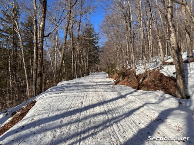
The night before this hike, temperatures dropped to 10 degrees. That meant that the trails would likely be frozen in the morning and not require snowshoes. It turned out I could walk the first two miles without any traction or floatation at all. When I got to the summer trailhead, I put on Hillsound Trail Crampons and caught up with Barb who’s started a little earlier.

People who hike Carrigain in winter often don’t follow the current trail but detour onto two stretches of the trail that have been rerouted and are no longer maintained. If you just follow the broken-out trail you probably wouldn’t realize this unless you were carefully tracking your route with a GPS. These old sections are marginally easier and merge back onto the main route eventually. Try as they might, the Forest Service has a hard time getting hikers to follow the new segments in winter.

All of the streams crossing on the lower half of the Signa Ridge Trail were open and unbridged, but the water level was pretty low and we could rock hop across them fairly easily. But the snow had started to soften in the morning sun and I switched to snowshoes at 2000′, at the bottom of the long sustained climb to the above treeline section of the Signal Ridge Trail that overlooks Carrigan Notch and Mt Lowell. The portion of the trail switchbacks up the south side of the mountain and gets a lot of sunlight, so you really needed snowshoes for the ascent.

Barb, bless her, kept up her steady cadence all the way to what I call “the waiting room”, which is a small but protected clearing at about 4300′ before you step out on the ridge in full exposure. We stopped there and wolfed down food and water and rested a bit.
She told me that she’s been thinking about blowing off this hike but came because I wanted to do it and I told her that I had thought about blowing it off and only came because she wanted to come! We’ve both done quite a few long routes already this April, some together, so we were still tired from those hikes. It was a funny exchange.

Signal Ridge is a glorious open ridgeline above Carrigain Notch, but you still need to hike to the other end of it and ascend another 300′ or so to the mountain summit. There’s a viewing platform on the summit that you can climb, from which you can see 44 of the 48 four thousand footers on the White Mountain 4000 footer list. Needless to say, the views of the surrounding mountains and terrain are absolutely tremendous, as is the view of Signal Ridge.

What goes up must come down. So after a relaxing viewing session, we started the long hike out the way we’d come. The snow had softened some in the warm weather, but going down is always much easier and faster.
While this was the last trip I needed to Carrigain for The Grid, I know I’ll climb this peak again….only not in April!
Recommended Guidebooks and Maps:
SectionHiker is reader-supported. We independently research, test, and rate the best products. We only make money if you purchase a product through our affiliate links. Help us continue to test and write unsponsored and independent gear reviews, beginner FAQs, and free hiking guides.