
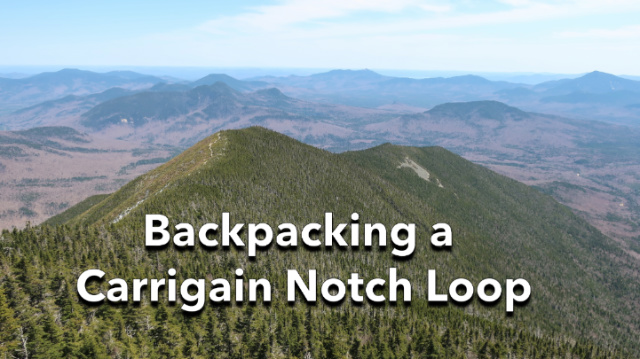
Carrigain Notch is a wild mountain pass between Mt Carrigain and Mt Lowell in the Pemigewasset Wilderness. It’s a deep chasm that’s seldom hiked end-to-end unless you want to penetrate deep into the White Mountain National Forest on a backpacking trip far from a paved road.

I recently backpacked through the Carrigain Notch in order to reach the north side of Mt Carrigain, to make an ascent from that direction on the Desolation Trail instead of following the Signal Ridge Trail, which is the most popular route, to the summit. I wanted to climb Carrigain again in order to stay at the designated Forest Service campsite which is located just below the summit, which I’ve never camped at before. I’m adding new easier trips to my free online guidebook this summer, Backpacking the White Mountain 4000 footers, and I wanted to check to see if my route would make a good trip plan for a 1-night Mt Carrigain Loop.

Signal Ridge Trail – the first river crossing
The Route
I left the Sawyer Pond Rd Trailhead and headed up the Signal Ridge Trail to the first river crossing. The water was running a bit high but I was able to get across mostly dry by rock and log hopping. The bog bridges below the Carrigain Notch sign came into view and I turned on the Carrigain Notch Trail. I’ve hiked this trail before, but it’s been a few years and I couldn’t remember if you could see Mt Lowell from the trail.

I was surprised, however, by how eroded, wet, and muddy the trail has become. The last time I hiked it I was in snowshoes in April, but this time I was in trail runners. One thing I did note, was an abundance of excellent spots for wild camping, just a short distance away from the heavily traveled Signal Ridge Trail with some potential for small stream fishing. I have to remember this the next time I want a short trip to the area.
Despite the trail conditions, I was making excellent time. But, I couldn’t see much in the notch and only got partially obstructed views of Mt Lowell through the trees. That was a disqualifying criterion for routing the first day of a guidebook trip past it. I’d hoped for something a little bit more dramatic for the first day of the trip plan.

I soon passed the big rock on the trail which is the starting point of the Vose Spur bushwhack and started to climb up to height of land in the Notch, where the Wilderness Boundary is. Once past HOL, the trail began a gradual descent toward the highly eroded area of terrain before the Nancy Pond Trail junction. There’s so much erosion, probably from snowmelt, that the landscape has been carved up into tiny archipelagos, or so it seems, with streambeds running around them. There was a time years ago when the trails through this area were very poorly marked but they’re much easier to find and follow today.
When I arrived at the Nancy Pond Junction, I turned left and headed toward Carrigain Brook and the Desolation Trail junction. This was a spooky section of the trail with towering vegetation on both sides like a tunnel. I started making some sounds, clicking my poles and shouting “Mr Moosey” to ward off any moose that might come crashing through from the sides. This area is true wilderness deep in the Pemi and the isolation can be a little intimidating.
The Desolation Trail climbs Mt Carrigain from the north coming out at Mt Carrigain summit and firetower. It’s very steep, climbing 2500′ in 1.9 miles. The first 1500′ of that climb are fairly easy over a trail covered with spruce needles. The next 500′ is an intense vertical scramble over wet boulders and tree roots, requiring hands/arms and feet to ascend, while the final 500′ is a slightly less intense, but steep rocky trail.

Knowing that I would be dry camping at the summit tent site, I filled up my reservoirs with 4L of water for camping overnight. That added close to 10 lbs to my load and would make the climb much more strenuous. There is an old well about 250′ vertically below the campsite on the Signal Ridge Trail, used when there was a fire tower at the summit, but I don’t trust the water quality and most of my friends don’t either. There’s no telling what crap has been thrown into that well over the years. The Forest Service sign warning people about it has been removed, I noted the next day when I hiked past it. Your mileage may vary. I opted to carry water up.
Despite the added water weight, I made pretty good time on the climb, finishing the first 1500′ in an hour and the second 1000′ in the second hour. But between the humidity and my exertion, my clothing was absolutely soaked by the time I reached the summit. Unfortunately, it was clouded over and a bit chilly, so I layered up with a Polartec Alpha hoody and a rain jacket and hiked down to the summit campsite, which is about 20-40′ lower in elevation.

I didn’t have any beta about whether the campsite had a water source and after scouting around it a bit, I concluded that it didn’t, so I proceeded to set up my tent and make camp. I’d brought along the new Tarptent Dipole DW 1 on this trip but quickly found that there weren’t any good spots to pitch it that were level and didn’t have roots or rocks in the middle of them.
I also found that the Dipole “wants” its tent stakes sunk pretty deep into the ground, which was difficult at this site because there were so many rocks in the soil. I ended up dragging the tent between a few different sites before I finally found soil that was deep enough to get a good stick. If you decide to camp here, bring a freestanding tent or a hammock.

Once the Dipole was pitched, I made a simple hot meal with a few packets of instant oatmeal in a Jetboil, and only then did I start to warm up and get comfortable again. The tent site, like the summit, was shrouded in cloud, so I got into my tent, changed into dry clothing, and warmed up under my quilt before falling asleep.
The next morning I was woken up by a spruce grouse dive-bombing my tent, something that’s happened to me before at other tent sites. They get territorial. So I got dressed, retrieved my Ursack, and made some hot tea for breakfast before packing up my gear. It had rained most of the night, so the exterior of the tent was soaked, but I was nice and dry inside. There hadn’t been an internal condensation transfer. To pack, I segregated the contents of my pack into dry and wet zones using my pack liner and the schnozzle stuff sack I use to inflate my sleeping pad and took off for the 4.5-mile hike out.

The Carrigain summit was still socked in but I did get some views when I walked out onto Signal Ridge which is several hundred feet lower. The cloud cleared enough that I could see undercast, a cloud inversion, over the Crippies, a distinct ridge in the distance. No one knows why they’re called the Crippies. After that, it was just a long descent on the rocky Signal Ridge Trail which I’m quite familiar with, having climbed Carrigain over a dozen times.

Having tested this route, I’ve decided against including it in Backpacking the 4000 Footers. Between the Desolation Trail ascent, the 4L water carry, and the crappy campsite, it just doesn’t pass muster as a “fun” trip plan. Despite that, this was a rewarding hike along several other dimensions and a good workout, although I wish the weather had been better. I do like hiking on more remote trails, like the Carrigain Notch Trail, and sleeping outdoors – and those itches got scratched in a satisfying way on this route. I just don’t think it makes a good guidebook route.
Recommended Guidebooks and Maps:
SectionHiker is reader-supported. We only make money if you purchase a product through our affiliate links. Help us continue to test and write unsponsored and independent gear reviews, beginner FAQs, and free hiking guides.