
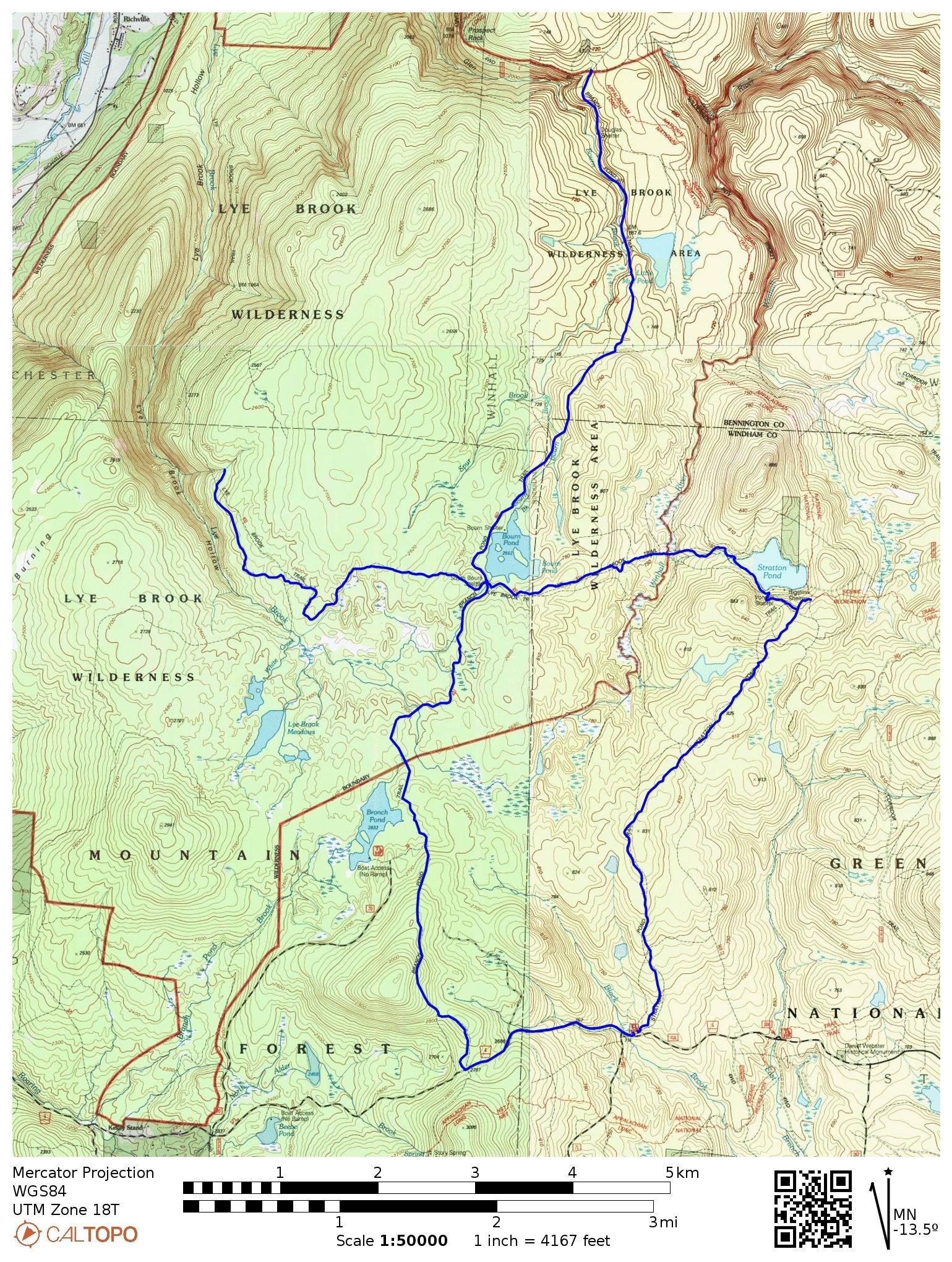
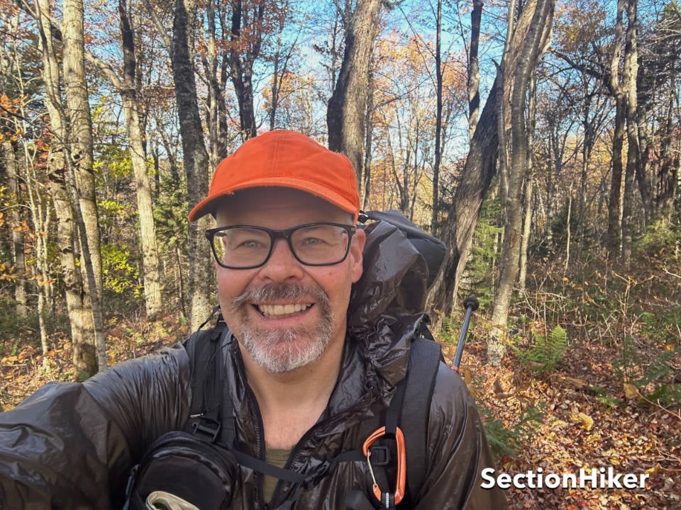
I managed to get out before the crowds this past Columbus Day weekend (not that there are crowds in the Green Mountain National Forest like the ones in the White Mountain National Forest) to backpack some of the longer trails to Stratton Pond and in the Lye Brook Wilderness Area. This area abuts the Long Trail between the Stratton Mountain Ski Resort and Manchester, Vermont. The area is peppered with ponds and bogs full of migrating birds, and the hiking is relatively flat, with few big hills to climb. Conditions were perfect for enjoying the autumn splendor in a wilderness area and hiking some fast miles.
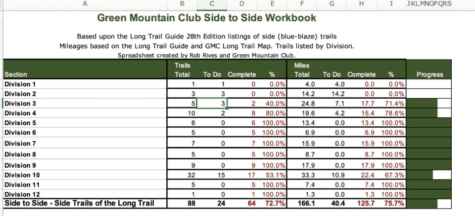
If you’ve been following my adventures this summer and autumn, my hiking miles have concentrated on finishing the Green Mountain Club’s Side-to-Side trail list. This list contains all of the side trails, also known as blue blaze trails, leading to the Long Trail, which I hiked way back in 2008. My friend Ryan, also known as “Guthook,” hiked the side trails when he worked on the GMC trail crew long ago, and he was my inspiration for this undertaking. It’s been a wonderful project so far, taking me to many regions of Vermont as I contemplate a move to the state. If you want a challenging and rewarding trail list in Vermont to sink your teeth into, I’d highly recommend it.
But the early arrival of colder temperatures, snow at higher elevations (mainly Mt Mansfield), and fewer hours of daylight means the race is on to see whether I can finish the list this autumn or if I’ll still be working on it in the winter months. If we get significant cold and snowfall, there’s a real chance I may have to postpone the completion until next year. But until then, I’m making full use of the decent weather days needed to polish off the above-treeline and more remote trails I need to finish.
That involves sequencing my remaining hikes to reduce the number of days and trips needed to complete the required miles. I’m no stranger to this process, having hiked all the trails in the White Mountains twice, a list known as “Redlining the Whites.” The climate and access limitations between those two locations are similar, although the Redline is a much larger trail list with over 650 trails.
This explanation justifies the seemingly whacky route I took on this latest backpacking trip, which involved hiking out-and-backs and partial trails to avoid subsequent trips or hikes in darkness with the shorter days of autumn and winter. While following a less-maintained trail through a wilderness area with minimal blazing is challenging when the tread is obscured by leaves, doing it when it’s covered in snow with fewer hours of daylight is a lot sketchier and best avoided. Why not just spend more days to cover all the required trails? I have other personal and business-related commitments that require my attention, too. Hopefully, there will be more news on that front soon.
Day 1
- Stratton Pond Trail 3.7 (miles)
- Lye Brook Trail West 2.4
- Branch Pond North 4.0
- Branch Pond South 4.0
- Camp at North Bourn Pond Tenting Area or thereabouts
Day 2
- Lye Brook Tr East 2.8
- Lye Brook Tr West 2.8
- Branch Pond South 4.7
- Road Walk West to Car 1.2
The first day involved driving to the Stratton Pond Trailhead, which ate up a few hours of the morning, limiting the amount of daylight I had to 8 hours (sunset is now 6:30 pm). I only got on the trail at 9:30 am and knew I’d have to hunker down to get the miles I wanted. The plan was to hike up the Stratton Pond Trail to its junction with the Long Trail, then double back to the Lye Brook Trail junction and follow it to the Branch Pond Trail. From there, I’d hike the upper half of the Branch Pond Trail to its junction with the Long Trail for 4 miles before doubling back and hiking the same trail 4 miles south.
The next day, I’d hike West along the Lye Brook Trail again for 2.8 miles (about an hour) before doubling back again. The Lye Brook Trail is 9.3 miles in its entirety, and I knew I didn’t have time to finish the entire thing, so my goal was to hike enough of it on this trip that I could come back and finish the rest as a day hike, rather than requiring an overnight backpack to polish off the remaining miles. Day hikes are a lot easier to fit into my schedule than overnights.
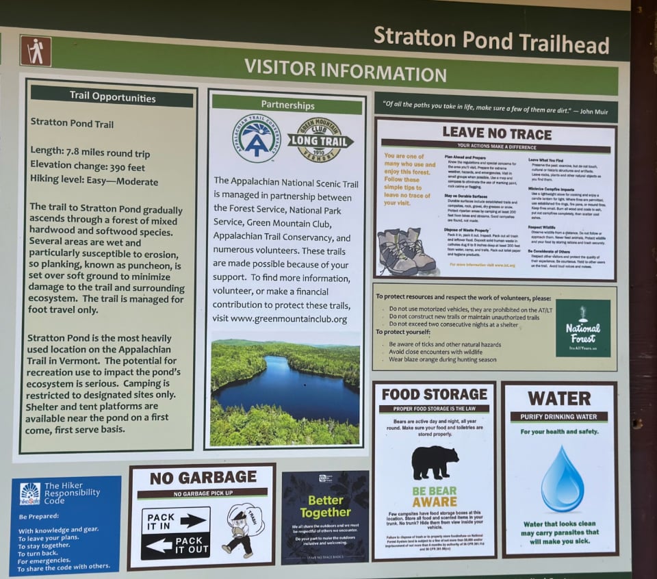
Stratton Pond Trail
The Stratton Pond Trail is one of the most popular trails in Vermont, but my car was the only one parked at the trailhead that morning. That always gives me pause and I hoped it wouldn’t be vandalized overnight. Nothing to be done, so I put it out of my mind and got on the trail.
The leaves on the surrounding trees had mostly dropped, which was surprising since the foliage farther north was still pre-peak. The trail was well traveled, though, judging by the leaf litter, which was more pulverized than on the trail and along the edges. I needn’t have worried because the trail was well-blazed with blue paint on the trees.
The trail follows low rolling hills with little elevation gain, making for fast hiking. Suddenly, I heard a commotion and saw a small grey bobcat racing toward me on the trail, only veering off at the last second into the adjacent woods. Five seconds later, a much larger and darker bobcat gave chase, racing up a tree when it saw me before leaping off and heading back the way it’d come. I can’t explain it, but the words to Jimi Hendrix’s version of All Along the Watchtower immediately came to mind, though bastardized, “two bobcats approaching, and the wind began to howl.” Funny what comes to mind when you’re walking and not thinking about much.
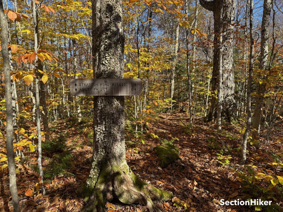
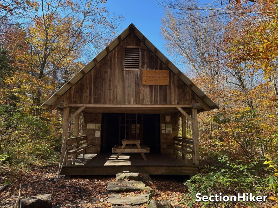
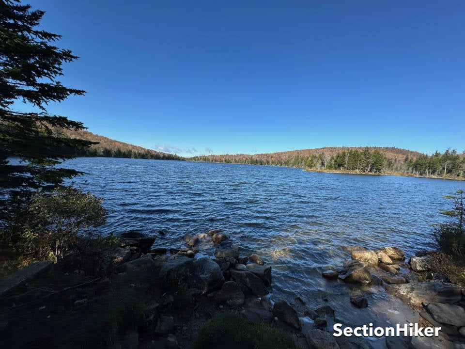
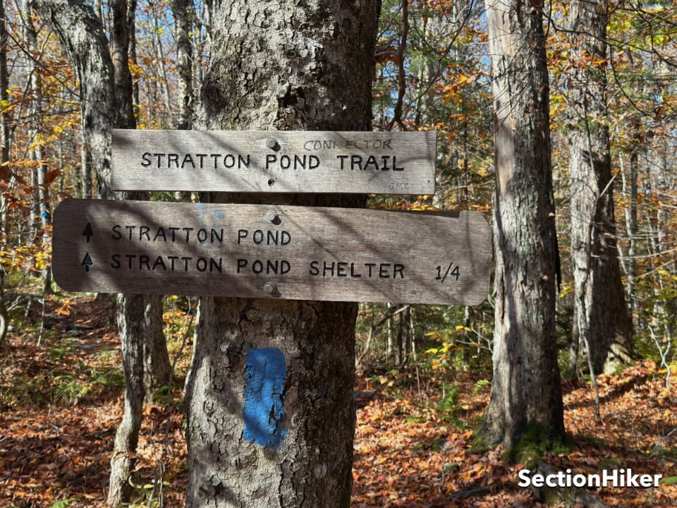
As I approached Stratton Pond, I blew right by the Lye Brook Trail Junction sign, which I’d have to search for later, and came to some quite confusing trail signage about the location of the Stratton Pond Shelter and caretaker’s tent. I needed to refill my water and figured there would be a water source near the Shelter, but there wasn’t. The shelter was also far smaller than I remembered from my last visit in 2008. So I hiked back the way I’d come and down to the Pond itself, where there was supposed to be a spring along the shore. It was dry, so I retrieved water from the pond and filtered it.
A cold wind blew across the water, so I put on my windshirt, cameled up, filled my bottle again, and set off looking for the Lye Brook Trail Junction. I was on the verge of asking the caretaker for help, when I spotted a sign for the Stratton Pond Connector, which I’d also walked past. It is an extension of the Stratton Pond Trail I’d hiked in on, connecting it to the Long Trail. Chagrinned, I hiked up it to the Long Trail junction and then back before retracing my steps down the Stratton Pond Trail to the Lye Brook Trail Junction, which I subsequently found.
None of these trails are clearly marked on the GMC’s digital Avenza Map, either because the map lacks the necessary resolution, it’s outdated, or it emphasizes the Long Trail and not the side trails. If I become more involved with the GMC, I think I’ll advocate raising the profile of the side trails in the halls of power because I’ve gotten so much satisfaction from hiking them. They constitute about 40% of the trail miles that the GMC maintains and they probably need an advocate.
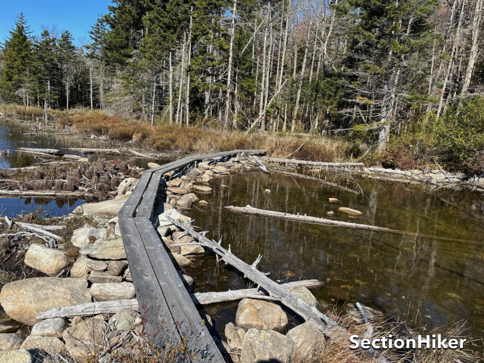
Now on the Lye Brook Trail, I headed west again over rolling hills. It follows the shoreline of Stratton Pond, and I enjoyed the pretty scenery on the other side of the pond. I crossed over a boardwalk and passed a spur to a camping area, which I did not investigate but hope to in the future. This is an area worth a repeat visit.
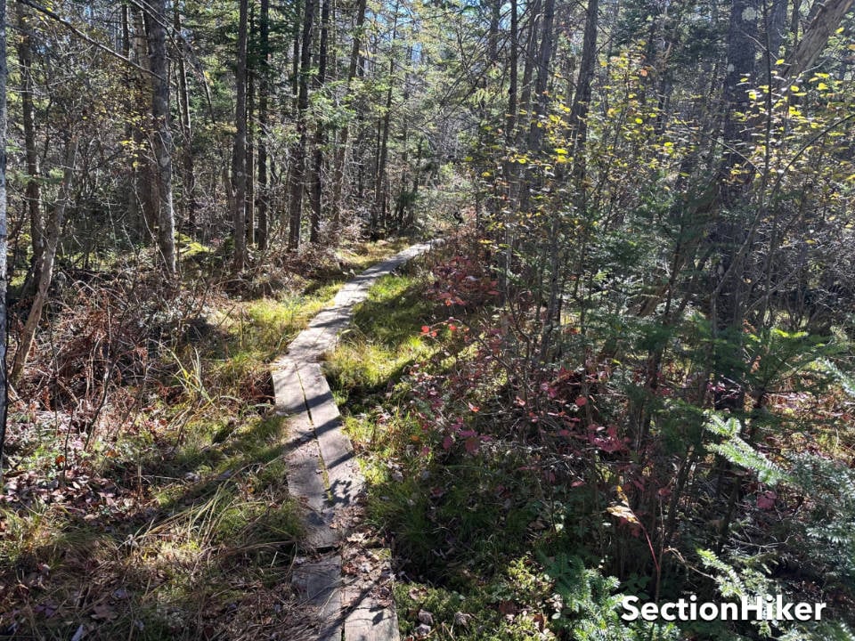
The trail continues along a brook before weaving through a maze of low spruce and dense woods abutting a bog. I crossed a stream at the Lye Brook Wilderness boundary and eventually came to another tenting area at the Branch Pond trail junction. I hopped onto the Branch Pond Trail and headed north for 4 miles to its junction with the Long Trail, unsure how easy it would be to follow since it travels through a wilderness area. Trails in designated Wilderness Areas are usually far less blazed to enhance the wilderness experience. I needed not have worried as the trail follows an old logging road much of the way that is easy to follow.
I flew up up this section of trail, admiring the stream alongside it which will be a future fly fishing destination. The streams in Vermont have been pretty low this year, which is just as well, as I’ve been focused more on hiking than fly fishing. But I have been cataloging great Tenkara fishing destinations and this will be one of them.
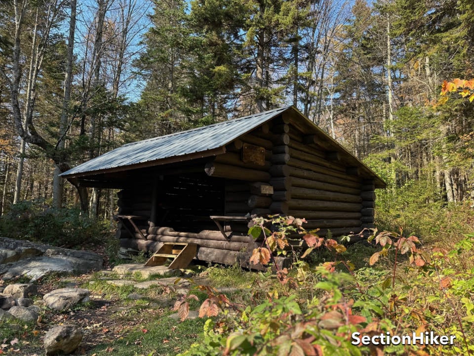
I passed by the seldom-used Douglas Shelter. It’s a half mile south of the Long Trail, so it’s unsurprising that people skip past it. I continued to the Long Trail junction, filtered some water, and turned back around heading south along the same trail for another 4 miles. I really wanted to get back to the tenting area near the Lye Brook junction before dark to settle in, cook dinner, and relax.
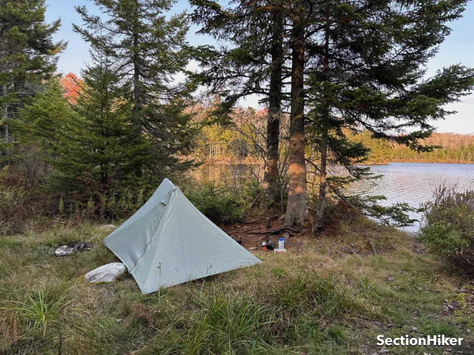
The good campsites were all gone by the time I arrived back at the tenting area, so I used a pre-existing tent site near the pond that I’d sped earlier. I set up my Durston silpoly X-mid (my favorite tent), which I haven’t had a chance to use all year, filtered water, and cooked dinner. It was cold, so I slipped under my quilt, warmed up, and soon fell asleep.
Lye Brook Trail
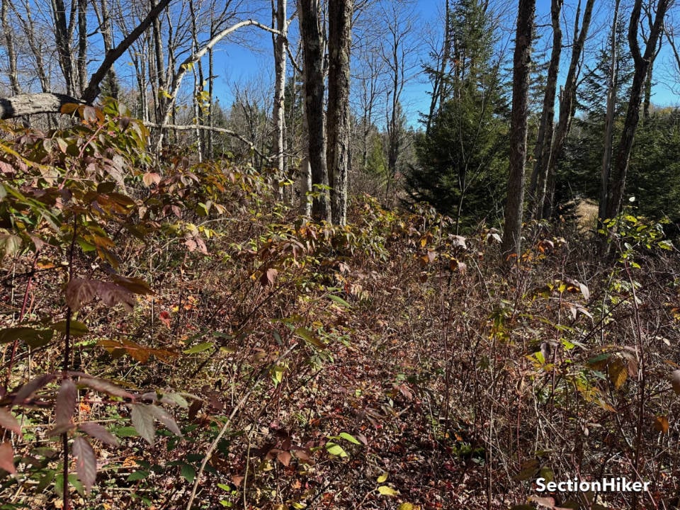
After a hot breakfast of Cream of Wheat fortified with pecans and cranberries, I headed west again along the Lye Brook Trail to further reduce the mileage I’d have to day hike on a return trip to finish the trail. This section of the trail gets far less use than the others in the area, though, and following it was much more difficult. In addition to being covered with leaves, parts of the trail are quite overgrown, and it could really use a good brushing. While blazed, the blazes were far more sporadic.
While the trail was more challenging to hike, I enjoyed myself and the problem-solving required to follow it. But I got to thinking, “why is this trail even on the side-to-side list?” It never intersects the Long Trail, which is supposed to be the criteria for inclusion. There are other trails on the list that do not meet that standard as well, like:
- Frost Trail
- Cantilever Trail
- Butler Lodge Trail
- CCC Road
- Wampahoofus Trail
- South Link
- Haselton Trail
- Rock Garden Trail
- Bald Mountain Trail
- Wanderer Trail
- Beaver Meadow Trail
- Black Swamp Trail
There are also trails that should obviously be on the list, like the Old Rootville Road Trail but aren’t. One of these days, I plan to get an explanation from the GMC. In the meantime, I’m perfectly happy to hike the trails on the side-to-side list, if only for tradition’s sake.
I continued for about an hour west before turning back around and hiking back to the Branch Pond Trail Junction, this time turning south to hike another 4.7 miles back to Kelly Stand Rd. This section of the trail is quite easy to follow and gets much more use. I met several groups of hikers and backpackers heading up the trail, having parked off a side trail at Branch Pond. I continued past that point, climbing the only significant hill of this hike before hitting the road and following it 1.2 miles to my car. The parking lot was now jammed with cars, and my car had weathered the night unmolested.
This was a short trip but a good one. I’d met all my goals with time to spare and look forward to hiking more trails on the GMC side-to-side list.
Vermont Trail Guides and Maps
SectionHiker is reader-supported. We only make money if you purchase a product through our affiliate links. Help us continue to test and write unsponsored and independent gear reviews, beginner FAQs, and free hiking guides.