
Mt Hunger is a mountain in Vermont’s Worchester Range just outside of Stowe and within spitting distance of Mt Manfield, the state’s highest peak. Having sampled the Worchester Range with a hike up to a viewpoint called Stowe Pinnacle last winter on a foggy day, I was eager to return to get a clear view of Mansfield and its subsidiary peaks.
For this hike, I teamed up with a very experienced group of hikers from the Green Mountain Club’s Ottauquechee section who hike together frequently. I’ve been sampling Vermont hiking this summer and networking with club members since that’s the most expeditious way to meet hikers in the state.
The GMC is divided into different geographic sections, but each can run trips anywhere in the state and even in neighboring New Hampshire. I’ve been signing up for GMC hikes that coincide with the Long Trail Side-to-Side trail list I’m working on, and I’ve also volunteered to lead my own GMC hikes this month and next to meet even more people. I still hike solo, but it’s fun to connect with new people and learn about other hiking and backpacking opportunities that I don’t know about.
Several different trails lead to Mt Hunger, but for this hike, we climbed the Middlesex Trail, which approaches the peak from the south. From the summit, we descended to the Bob Kemp Trail, hiked out to neighboring White Rocks Mountain, and lollipopped back to the Middlesex Trail trailhead. The hike was about 6 miles with 2500′ of elevation gain.
Finding the Middlesex Trail trailhead was half the adventure since it’s in a dead cell phone zone and requires traversing multiple dirt roads. Navigating in Vermont is “interesting,” to say the least, and I’ve found that driving with a detailed Delorme Road Atlas is vital since there are so many dirt roads crisscrossing the countryside.
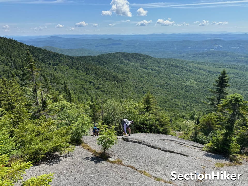
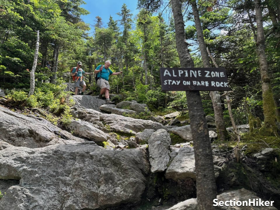
The first section of the Middlesex Trail was an easy woods hike up to the Bob Kemp trail junction. From there, the trail gets very steep before turning into a rock edge climb. I was glad that I’d worn my La Sportiva Wildcat Trail Runners that day because they have such outstanding traction on bare rock, wet or dry.
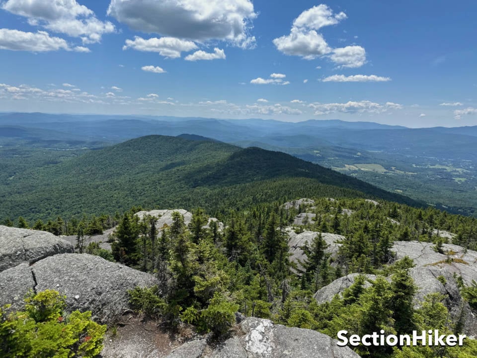
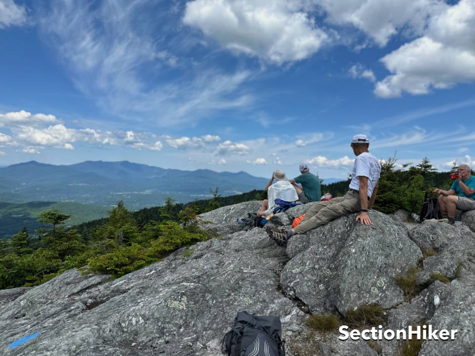
The effort was well worth it though since we had fantastic views of Mt Mansfield over lunch at the summit. I could pick out all of Mansfield’s subsidiary peaks and visualize the trails that climb them.
We descended the West Side of Hunger to the Bob Kemp trail and hiked out a spur to White Rock Mountain which is just south along the Worcester Range, scrambling over more rock ledge en route. The views there were equally impressive from the bald summit.
The descent down the Bob Kemp Trail was substantially easier than the scrambles up the Hunger and White Rock. If you go on this hike, I encourage you to take the route we did, going up the Middlesex Trail and back down the Bob Kemp: climbing down the ledges on the Middlesex Trail would be too sketchy. Anyway, this was a great route with a group of very seasoned hikers. I’m sure I’ll connect with them again.
The Green Mountain Club’s Waterproof Northeast Kingdom Hiking Trail Map is the best paper map for this hike. It’s also available as a digital map in the Avenza Maps App.

SectionHiker is reader-supported. We only make money if you purchase a product through our affiliate links. Help us continue to test and write unsponsored and independent gear reviews, beginner FAQs, and free hiking guides.